If you weren’t already aware, the Environment Agency (EA) recently released their airborne-derived Lidar data as part of Defra’s open data policy, under Open Government Licence (OGL).
Lidar, which stands for Light Detection And Ranging, provides high-resolution digital surface models (DSMs) and digital terrain models (DTMs) of the landscape. Currently, the EA’s lidar offering covers approximately 72% of England’s land surface.
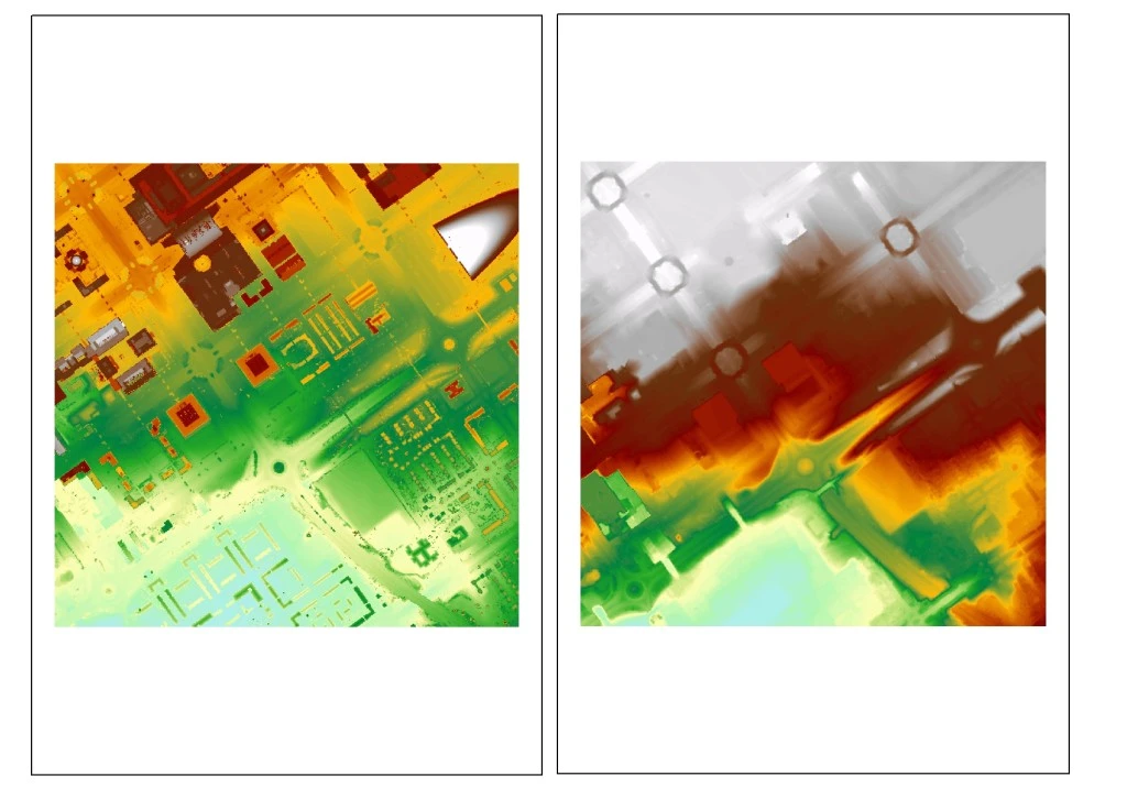
Comparison of a DSM, which incorporates all surfaces (e.g. buildings and trees), with that of a DTM which strips out all of the aforementioned is provided below.
DTMs and DSMs can be used for a number of applications. The Environment Agency have predominantly used them to assess flood risk to homes and businesses. It is the fundamental topographic basis for their flood models, assessments of coastal change and understanding land-use changes (see this previous blogpost).
From a soil science/geoscientist perspective, lidar can be used for detailed digital soil mapping,enhancing existing soil maps,understanding local landforms,micro-topography evaluation and evaluating soil moisture changes. I have used lidar data myself, within a 3D environment, to understand regional geological landforms of the Fenlands, near Ely, Cambridgeshire, UK (please take a look at this YouTubevideo).
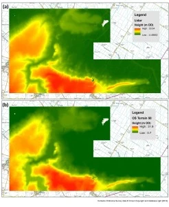
Lidar provides a much more detailed picture of the landscape, especially where topographic changes are extremely subtle in comparison to coarser topographic data. For example, data provided by the Ordnance Survey (e.g.OS Terrain 50andOS Terrain 5).
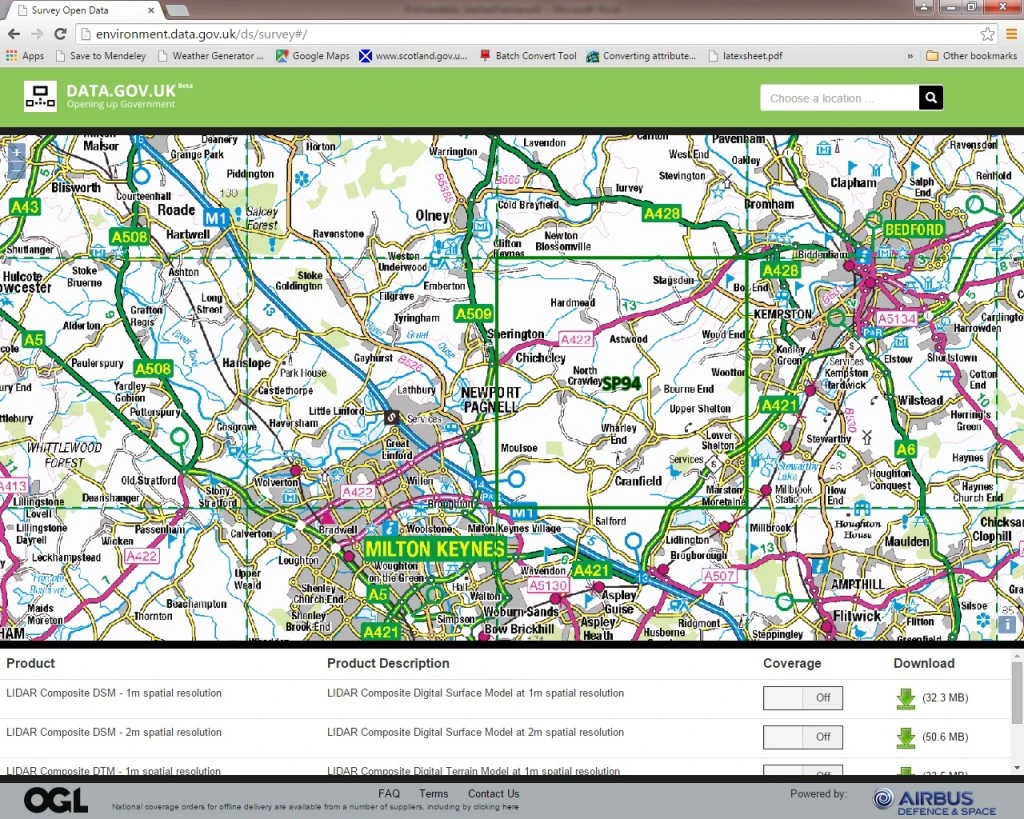
The lidar datasets can be downloaded via a web-based application, which can be foundhere (screenshot provided below). Files are downloaded as a zip file in the ASCII (.asc) textual raster file format. These can then be read by a number of GIS (Geographical Information Systems) applications. In this instance I used the open-source GIS, QGIS which can be downloadedhere. Furthermore, once in a GIS environment, a number of topographic variables can be calculated including, slope and aspect. A number of lidar resolutions are currently available including, 50cm, 1m and 2m. It is intended that 25cm resolution data will also be made available soon.
Martin Isenburg (@LAStools) in his recent blogpostpointed out however that the ‘insane’ vertical accuracy of the lidar datasets may be resulting in the seemingly large file sizes seen. With “ASCII numbers that specify the elevation for each grid cell written down with 15 to 17 digits after the decimal point”. So be prepared and have some spare data storage! Despite this, it is definitely a step in the right direction regarding open data. Hopefully this release will spur on lots of interesting [soil] science and further understanding of the landscape that we live in.
Have a go yourself, and if you aren’t too familiar with GIS systems, there are many forums (e.g. Stack Exchange), YouTube videos and tutorials on the QGIS websiteto help you out!
Author: O. Pritchard
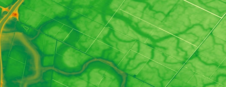
Cover image: Lidar derived 1m resolution reclassified image showing relict of dendritic channels, Fenlands, East Anglia, UK.